Site Visits That Keep Context From Walkabout to Report
Capture photos with location and camera bearing, sketch over design overlays, and export report-ready evidence without rebuilding the walkabout from memory.
Trusted by leading organisations
Join planning and development teams using PlaceChangers Site Visits


Related insight
Why site visit context goes missing
Many teams still spend time after a walkabout matching photos to maps, checking which direction each image faced, and rebuilding the story for reports. Our guide explains the common causes of site visit amnesia and how to avoid them.
Read the guideFocused Site Visit Features
Capture once—use the evidence across reviews, hand‑offs, and reports
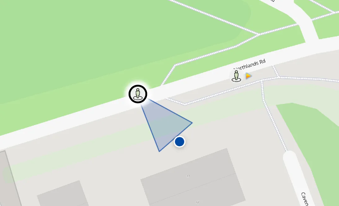
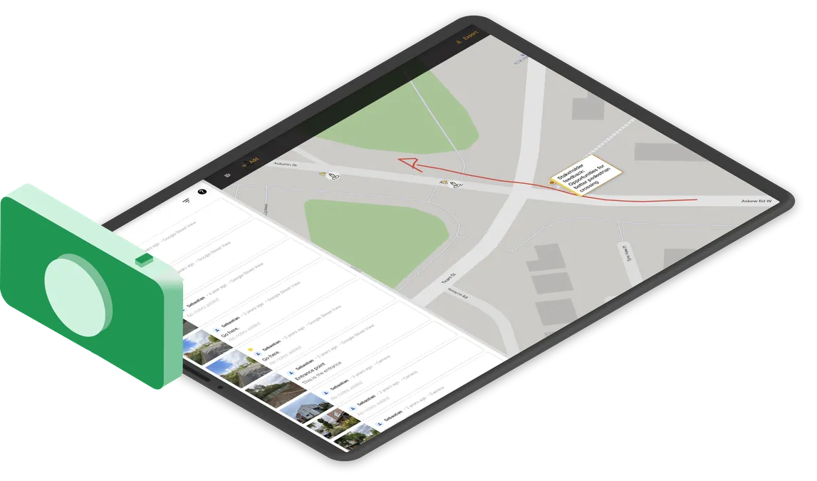
Plan routes with Street View, then capture photos and observations with location and camera bearing already attached—no manual GIS plotting after the visit.
Explore further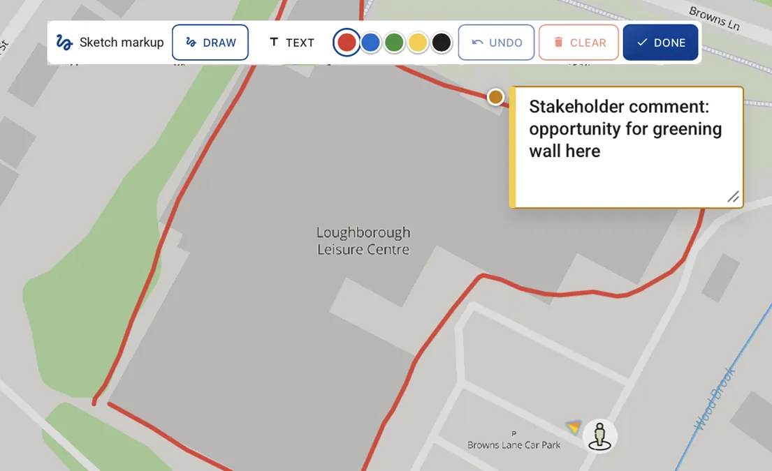
Sketch on the site map, add quick text annotations, and keep observations connected to the relevant masterplan or design overlay without turning every note into a formal observation.
Explore further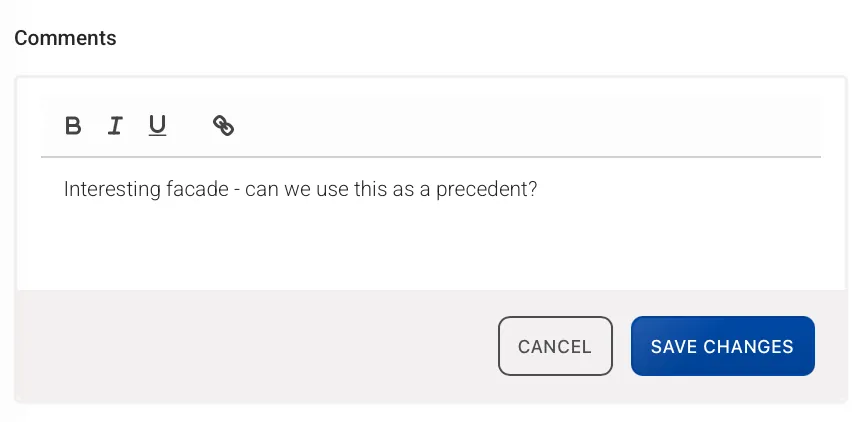
Consolidate site knowledge into a single shared map. Comment on observations, star priority items, and make sure teams and stakeholders are looking at the same context.
Explore further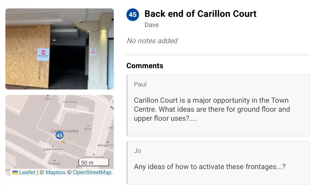
Produce clean, consistent outputs for reports and delivery: shareable interactive reports, printable observation reports, SVG/PDF visuals for design documents and slides, plus structured data for Excel and GIS.
Explore furtherTalk to the team
Need a tailored rollout or procurement answer?
If your team needs to understand rollout, device workflows, or how Site Visits fits your fieldwork process, we can help you plan the right next step.
Ready to stop rebuilding site visits from memory?
Start capturing mapped observations, markups, camera bearings, and report-ready site context from the first walkabout.